Шрифт
Цвет
Графика
Изображение точки

To see AR mode in action:

1. Install ARTEFACT app for iOS or Android;

2. Find the exhibition «Exhibition of Lenin House-Museum»

3. Push the «Augmented reality» button and point your phone's camera at the exhibit;

Скрыть точки интересаПоказать точки интереса
Показать в высоком качестве

Map of Simbirsk Governorate

Creation period
1869
Place of сreation
St. Petersburg, Russia
Dimensions
46x41 cm
Technique
typographic printing
Collection
3
Open in app
#1
Alexey Ilyin’s Cartographic Establishment
Map of Simbirsk Governorate
#3
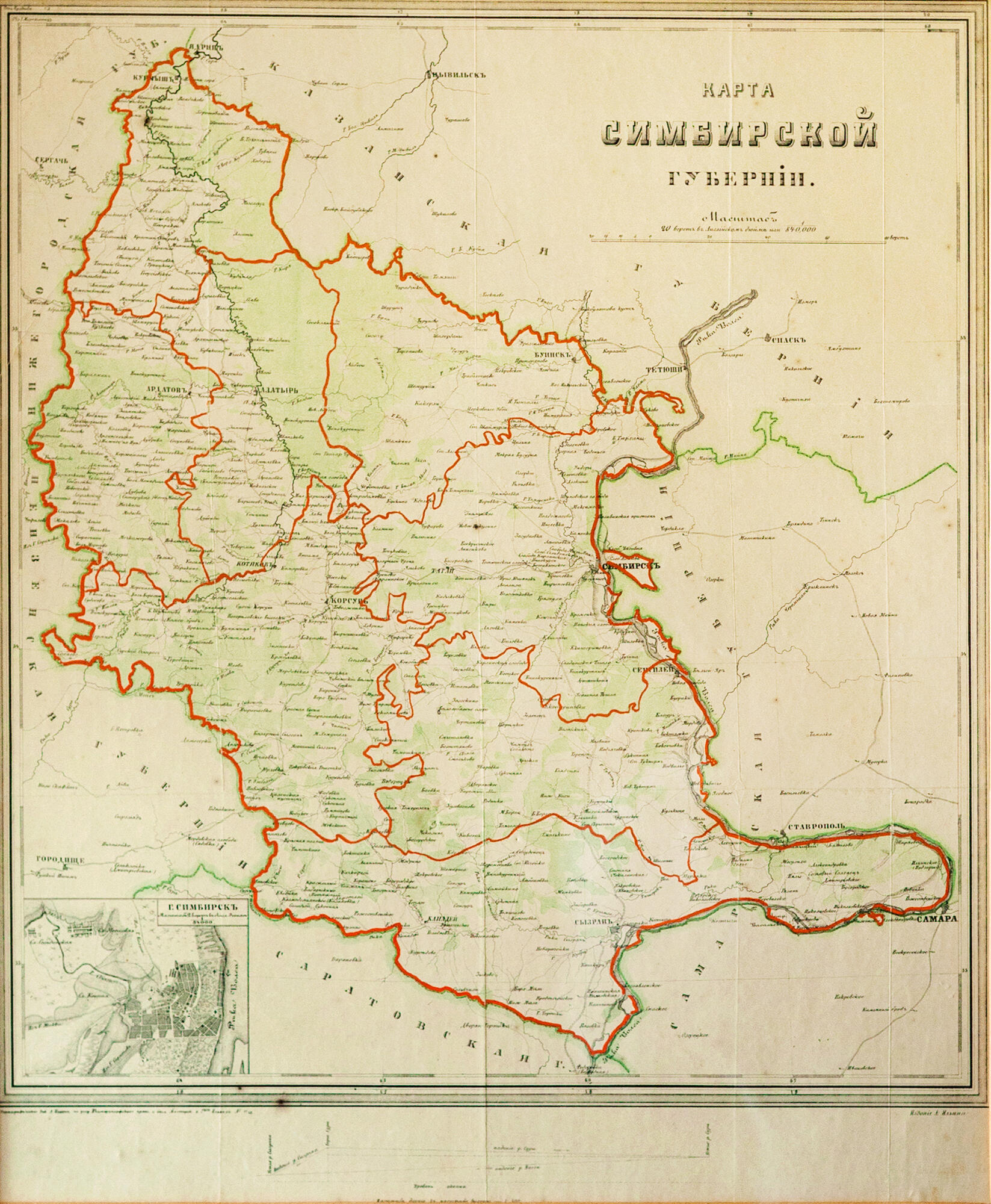
There is a small map of Simbirsk Province enclosed in a wooden frame with a folder on the wall in Ilya Ulyanov’s study. It was typographically printed at the cartographic Establishment of Alexey Ilyin in St. Petersburg.
These maps were usually appended to Commemorative Books and Address-Calendars, which were issued in each province as travel guides. The authors provided general and historical information and information about the employees. This map was a supplement to the Official Directory of Simbirsk Governorate in 1869, the year the Ulyanovs arrived in Simbirsk.

The eldest daughter, Anna Ulyanova-Elizarova recalled:
#11
Father was constantly traveling about the province, and outlined the routes of these trips on the map, which always hung in the study.
#12
The map of Simbirsk Province is drawn to an average scale: 20 versts per inch, or 8.4 kilometers per centimeter. It is a political and administrative map by the content. It depicts the borders of neighboring provinces in turquoise dashed lines and the borders of counties in green dashed lines. The map also shows roads, forests, rivers, lakes, springs, swamps, and woodless areas. The relief is marked with hatching.

There is a small inset map with a plan of the main provincial city of Simbirsk in the lower-left corner. On it, the compiler left the main streets unnamed, but showed major thoroughfares, such as ‘From Kazan’, ‘From Moscow’, and ‘From Saratov’.

By the beginning of the 20th century, Simbirsk Governorate covered 49,500 square kilometers or 43,491 square versts. It bordered in the north with Kazan Province, in the south with Saratov Governorate, in the east with the Volga River, separating it from Samara Governorate, and in the west with Penza and Nizhny Novgorod Governorate.
From 1851 to 1920, Simbirsk Governorate consisted of eight counties with county centers of the same name: Alatyrsky, Ardatovsky, Buinsky, Karsunsky, Kurmyshsky, Sengileyevsky, Simbirsky, and Syzransky.

On the map from the collection of the house-museum, the borders of the provinces and districts were additionally outlined in red watercolour, probably at a later date. This partially altered the structure of the administrative boundaries of the Simbirsk Governorate, distorting its eastern border.
#10
read morehide
00:00
00:00
1x

Map of Simbirsk Governorate

Creation period
1869
Place of сreation
St. Petersburg, Russia
Dimensions
46x41 cm
Technique
typographic printing
Collection
3
Point your smartphone camera to open in the app
Share
VkontakteOdnoklassnikiTelegram
Share on my website
Copy linkCopied
Copy
Open in app
To see AR mode in action:
  1. Install ARTEFACT app for 
  2. iOS or Android;
  3. Find and download the «Paintings in Details» exhibition
  4. Push the «Augmented reality» button and point your phone's camera at the painting;
  5. Watch what happens on your phone screen whilst you flip through the pictures.
 
We use Cookies
Cookies on the Artefact Website. We use cookies to ensure that we give you the best experience on our website. If you continue without changing your settings, we'll assume that you are happy to receive all cookies on the Artefact website. However, if you would like to, you can change your cookie settings at any time.
Подробнее об использованииСкрыть
Content is available only in Russian
%title%%type%