Шрифт
Цвет
Графика
Изображение точки

To see AR mode in action:

1. Install ARTEFACT app for iOS or Android;

2. Find the exhibition «Exhibition of Lenin House-Museum»

3. Push the «Augmented reality» button and point your phone's camera at the exhibit;

Скрыть точки интересаПоказать точки интереса
Показать в высоком качестве

Map of Europe

Creation period
second half of the 19th century
Place of сreation
St. Petersburg, Russia
Dimensions
81x99 cm
Technique
typographic printing
Collection
0
Open in app
#1
Alexey Ilyin’s Cartographic Establishment
Map of Europe
 
#2
The Ulyanovs' favorite place for family evenings was the spacious dining room. The family gathered here to play chess, read books, and talk. There were two geographic maps on the wall in this room.

Lenin’s elder sister Anna Ulyanova-Elizarova recalled,
#8
The furnishings were very simple, which is generally common among the middle class, the new items were bought on occasion <…> there were no portraits and paintings on the walls, the room had a puritanical atmosphere <…> there were geographic maps — my father bought them for the children.
#9
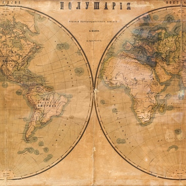
Geographic maps on the walls, according to Anna, were the family necessities, like a grand piano and books in the bookcases and on the shelves.

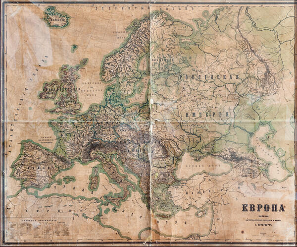
One of the maps on display is called ‘Europe’. This map is physical and partly general geographic by the content — it shows the topography, the appearance of the territory and water areas. It covers the territory of Outer Europe, a swath of North Africa, and the European part of the Russian Empire. The map is an overview one with a small scale of 100 versts to inch, or 42 kilometers to centimeter.

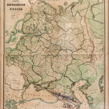
These maps were used for educational and introductory purposes and were commonly acquired for schools, gymnasiums, colleges, and universities in the Russian Empire.

The map shows Europe and the European part of the Russian Empire with physical and geographic features such as rivers, lakes, seas, oceans, bays, and straits. It shows the coastline marked with a bold light-blue stripe. Mountain ranges, plains, and lowlands are colored in layers by height classes. This technique is called hypsographic coloring. The higher points on the map are marked in brown, the map compilers also used beige, dark and light green according to the terrain level.

The map was produced in the second half of the 19th century at the Cartographic establishment of Alexei Ilyin in St. Petersburg. It was founded in 1859 by General Staff officers Alexey Ilyin and Vladimir Poltoratsky. By 1882, the establishment produced up to six million reprints, which were about 90% of the Russian Empire’s civilian cartographic output.
#7
read morehide
00:00
00:00
1x

Map of Europe

Creation period
second half of the 19th century
Place of сreation
St. Petersburg, Russia
Dimensions
81x99 cm
Technique
typographic printing
Collection
0
Point your smartphone camera to open in the app
Share
VkontakteOdnoklassnikiTelegram
Share on my website
Copy linkCopied
Copy
Open in app
To see AR mode in action:
  1. Install ARTEFACT app for 
  2. iOS or Android;
  3. Find and download the «Paintings in Details» exhibition
  4. Push the «Augmented reality» button and point your phone's camera at the painting;
  5. Watch what happens on your phone screen whilst you flip through the pictures.
 
We use Cookies
Cookies on the Artefact Website. We use cookies to ensure that we give you the best experience on our website. If you continue without changing your settings, we'll assume that you are happy to receive all cookies on the Artefact website. However, if you would like to, you can change your cookie settings at any time.
Подробнее об использованииСкрыть
Content is available only in Russian
%title%%type%