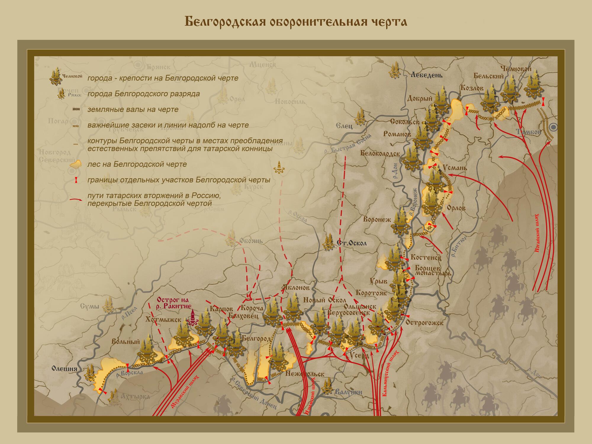
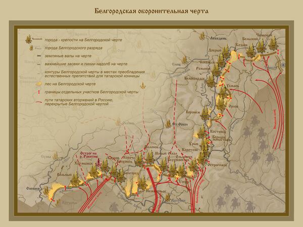
The construction of the Belgorod defense line began in the 17th century in order to protect the state from constant assaults from the south. It consisted of fortress cities and defensive fortifications with the length of many kilometers along several modern regions. They were 27 fortresses, and 9 of them were on the territory of the modern Belgorod Region.
Before the Belgorod Line, the southern part of the country was defended with special riders — guardsmen. Soldiers were selected from nearby urban settlements who were supposed to watch the boarder with the Crimean Khanate: they patrolled fords and messaged about the Tatar’s arrivals. By the 17th century, however, this system was no longer effective: the Tatars gave a wide berth to the guardsmen and assaulted cities — they looted houses and captured the locals. For the first half of the 17th century, they managed to capture over 150 thousand people.
In 1636, a rampart with the height of 2.5 meters and 28 kilometers in length was formed near the city of Kozlov (now — Michurinsk, Tambov Region). During the very first Tatar’s attack, it helped the guardsmen to fight the enemy back. In autumn of the same year, the nobleman Fyodor Sukhotin and the podyachy Yuryev (a clerk) went around the territory, surveyed the locals and made a plan of further construction of the defensive fortifications.
That’s how the Belgorod Line was created — 800 kilometers of defensive fortifications and 27 city-fortresses. It took its beginning on the territory of the modern Sumskaya Region, on the Polish-Lithuanian border. The lane went through Belgorod, Lipetsk and Voronezh Regions and ended in Tambov Region. It allowed to shut off the main ways which the Tatars followed: Muravsky, Izyum, Kalmiussky and Nogaisky highways (also known as “schlyakhi”, which meant a developed road in South Russia).
According to the documents, planned settlement along the Rakitna River began in the mid-17th century, when the Belgorod defense line was under construction. By the decree of Tsar Alexey Mikhailovich and the order of boyarin Repnin, service man Elizary Yakovlev and podyachy Zinovka Markov set the places to lay ostrogs (a small wooden fort): in 1652, a defensive ostrog appeared on the right upper bank of the Rakitna River. People started to settle there: Ukrainian and Russian migrants from border towns and Central Russia — Pskov, Smolensk, Tver Regions.