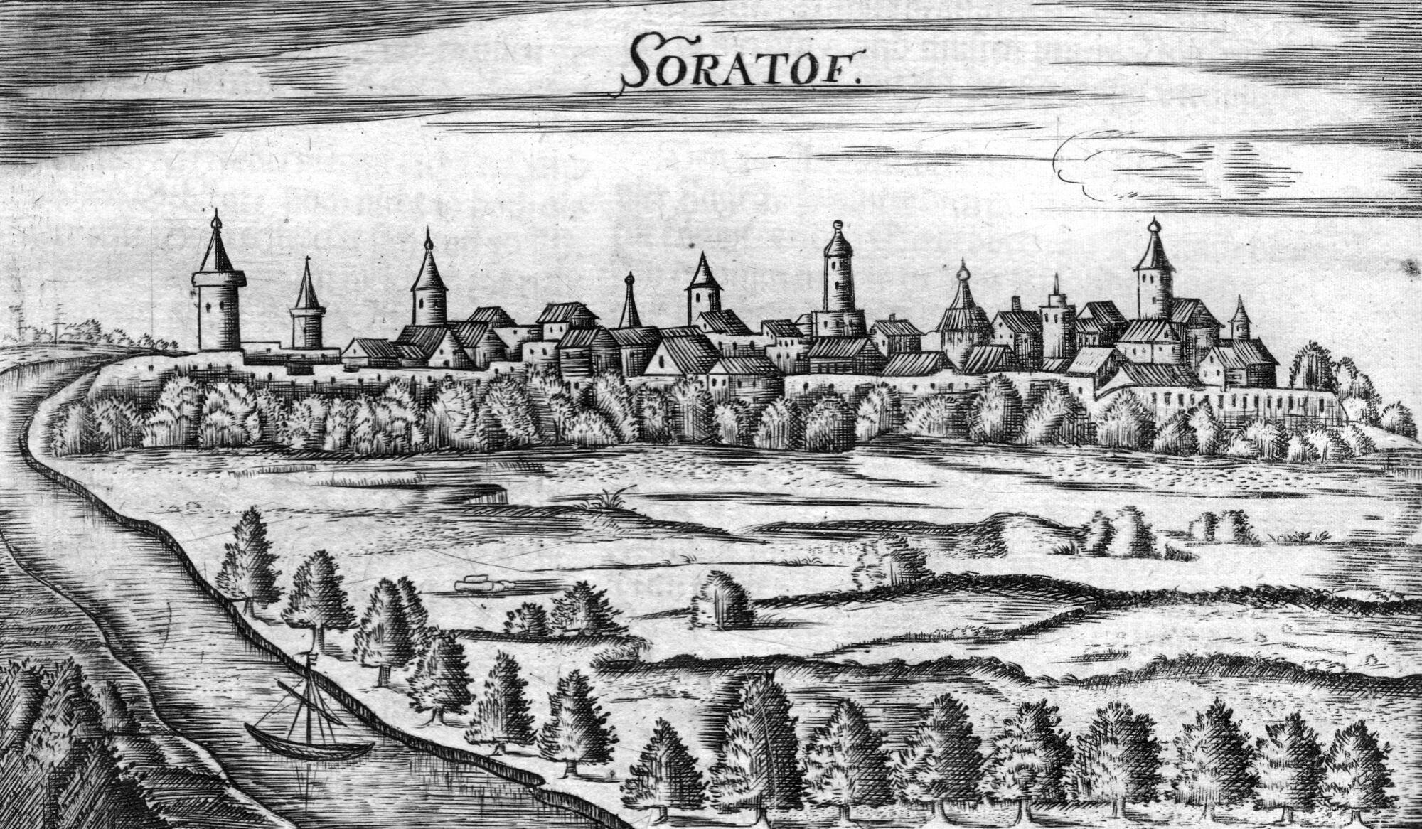
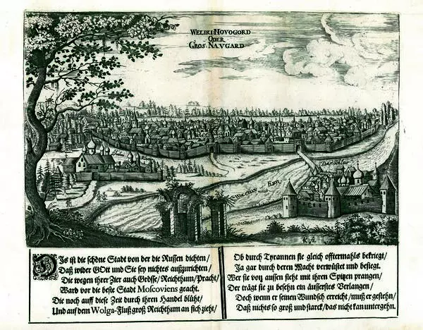
The exhibition at the local history museum showcases a drawing of the Saratov fortress that was made in 1636 by Adam Olearius, a German traveler, secretary, and adviser at the Holstein Embassy to Muscovy and Persia. This is the first image of Saratov that has survived to this day. The drawing is presented in the book by Adam Olearius Description of a Journey to Muscovy, and Through Muscovy to Persia and Back, which was published in Hamburg in 1696. Adam Olearius repeatedly visited Russia. In August-September 1636, he sailed along the Volga River with an embassy delegation heading to Persia. On September 1st, 1636, the sailing ship Friedrich, with the embassy delegation on board, passed by Saratov.
Drawing of the Saratov fortress
Время создания
1696
Размер
11x22 cm
Техника
Printing
Коллекция
3
Открыть в приложении#1
Adam Olearius
Drawing of the Saratov fortress from a book by A. Olearius Description of a Journey to Muscovy, and Through Muscovy to Persia and Back
#3
#4
… Before noon, at about nine o’clock, we sailed past Saratov, this city lies four versts (Russian unit of measurement) from the main river in a flat field, on a channel that the Volga throws from itself on the left bank. Only riflemen live here, under the control of the governor and the colonel…
Adam Olearius sketched the fortress, and wrote this about it in his diary
#2
Saratov, which was on the left bank of the river then, was located on a high triangular promontory formed by two river channels. Wooden walls, reinforced with truncated wooden towers, ran along the perimeter of the cape from its extreme tip. One was located at the sharp tip of the promontory, two others ran along the long sides, and three more were on the wide side that abuts the city from land. On the wide side, two ramparts were also erected between the trenches, with wooden palisades on them. The river served as additional protection.
The Saratov on the left riverbank was mentioned for the first time in 1616. The location of the city was well chosen: it was built on a cape between the Saratovka and Volozhka rivers, a channel of the Volga River. The city occupied about 17 hectares, and was separated by islands from the main channel of the Volga River. The main gate of the city was located in the central tower, on the side of the plain. In total, there were no more than 1,500-2,000 people in Saratov when it was on the left riverbank. According to Russian urban planning traditions, a wooden fortress was at the center of Saratov. Inside it there were two churches, a hut (the governor’s administrative office), a customs office, a gunpowder cellar, grain barns, rows of market stalls, and a tavern. The courts where the governor and riflemen commanders lived were also here. Outside the fortress’s walls there was a settlement. From the side of the steppe, it was protected by trenches, earthen ramparts, and a palisade. Behind the settlement, there was a territory surrounded by stakes that the townspeople used as hayfields, or for grazing animals and trading with nomads. Under the left wall of the city, there was a pier with sailing ships and boats. In 1674, the city was moved to the right bank of the Volga River.
The Saratov on the left riverbank was mentioned for the first time in 1616. The location of the city was well chosen: it was built on a cape between the Saratovka and Volozhka rivers, a channel of the Volga River. The city occupied about 17 hectares, and was separated by islands from the main channel of the Volga River. The main gate of the city was located in the central tower, on the side of the plain. In total, there were no more than 1,500-2,000 people in Saratov when it was on the left riverbank. According to Russian urban planning traditions, a wooden fortress was at the center of Saratov. Inside it there were two churches, a hut (the governor’s administrative office), a customs office, a gunpowder cellar, grain barns, rows of market stalls, and a tavern. The courts where the governor and riflemen commanders lived were also here. Outside the fortress’s walls there was a settlement. From the side of the steppe, it was protected by trenches, earthen ramparts, and a palisade. Behind the settlement, there was a territory surrounded by stakes that the townspeople used as hayfields, or for grazing animals and trading with nomads. Under the left wall of the city, there was a pier with sailing ships and boats. In 1674, the city was moved to the right bank of the Volga River.
#5
Saratov Local History Museum
читать дальшескрыть
00:00
00:00
1x
Drawing of the Saratov fortress
Время создания
1696
Размер
11x22 cm
Техника
Printing
Коллекция
3
Открыть в приложении
Поделиться
