Such a map was used by Duke Sergei Mikhailovich and his father Mikhail Nikolaevich during their first visit to the Urals. They took a trip around Russia in June 1887, when Sergei Mikhailovich was just 17 years old.

#1
Published by V.G. Chekan
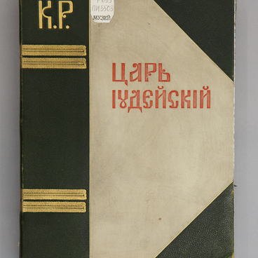
Travel Guide to the Urals
#3
#5
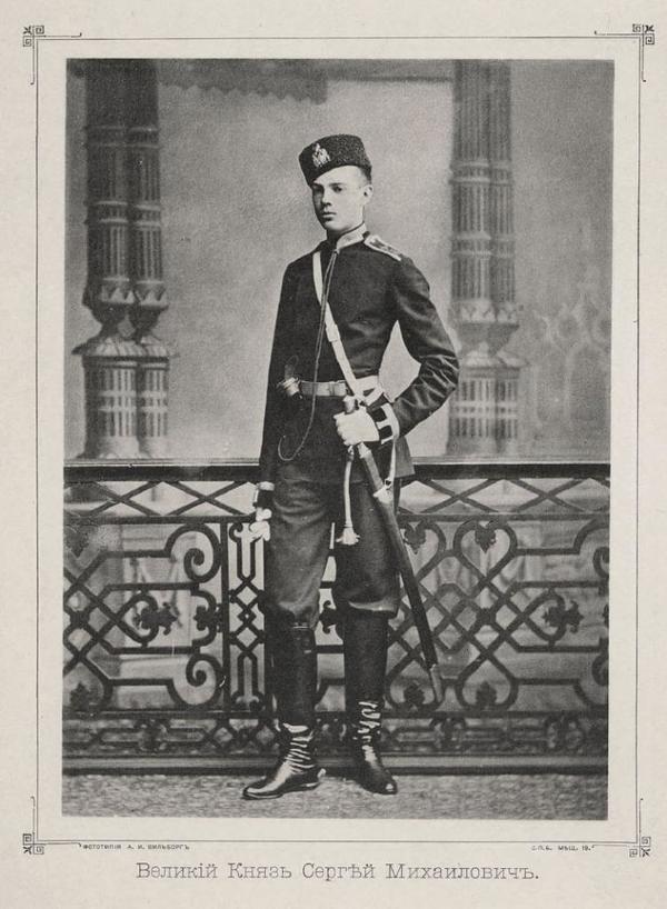
Grand Duke Sergei Mikhailovich. Source: Sverdlovsk State Regional Ethnography Museum
The dukes visited Perm and then went to Yekaterinburg. During their trip, the Romanovs studied the potential and specific aspects of arms and mining industries in Russia. By the end of the 19th century, there were many plants operating in the Urals and they were pre-marked on the map.
While in Yekaterinburg, the Romanovs visited the Siberian-Ural Scientific and Industrial Exhibition. It ran for three months and was visited by tens of thousands of viewers from various cities of the country.
While in Yekaterinburg, the Romanovs visited the Siberian-Ural Scientific and Industrial Exhibition. It ran for three months and was visited by tens of thousands of viewers from various cities of the country.
#6
Particularly popular were three scientific sections of the exhibition, where visitors were familiarized with geology, fauna and flora, artefacts and historical writings about the Urals.
During the trip, Duke Sergey Mikhailovich visited Alapayevsk, the place, where he would eventually be exiled to. He mentioned that fact in his conversation with security officer Kabanov, who accompanied the royal prisoners on their way from Yekaterinburg to Alapayevsk in 1918.
During the trip, Duke Sergey Mikhailovich visited Alapayevsk, the place, where he would eventually be exiled to. He mentioned that fact in his conversation with security officer Kabanov, who accompanied the royal prisoners on their way from Yekaterinburg to Alapayevsk in 1918.
#8
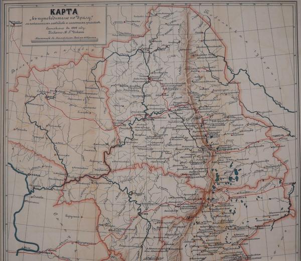
The detailed map to the ‘Travel Guide to the Urals’ was compiled in 1899 by Alexey Ilyin’s cartographic establishment, Russia’s first private enterprise of its kind. The Ilyins were a famous cartographers’ dynasty: they produced maps, thematic and geographical plans of cities, globes and atlases. The Ilyins supplied maps of schools around the country and their products were known for their high quality.
#9
The Urals map shows railways and major roads, rivers, industrial plants and gold mines, which were particularly abundant in the area. The scale of the map, as specified in the legend, is 60 versts to the English inch, which comes to about 64 kilometers to each 2.5 centimeters.
The travel guide contained descriptions of industrial facilities, such as factories, plants, mines and gold fields and provided information on special manufacturing features and history of enterprises. It also described settlements, monasteries and stations, and specified the names of rivers, mountains and mountain ranges.
#10
Sverdlovsk State Regional Ethnography Museum
read morehide
00:00
00:00
1x
Travel Guide to the Urals
Creation period
1899
Dimensions
49,7x44 cm
Technique
Photocopy
0
Open in app
Share