Russian Pomors laid the foundation of a new type of seafaring – ice navigation. They brought under control harsh northern waters or ‘studioniye’ seas, could calculate time by the sun and stars, and knew characteristics of ebb and flow very well.
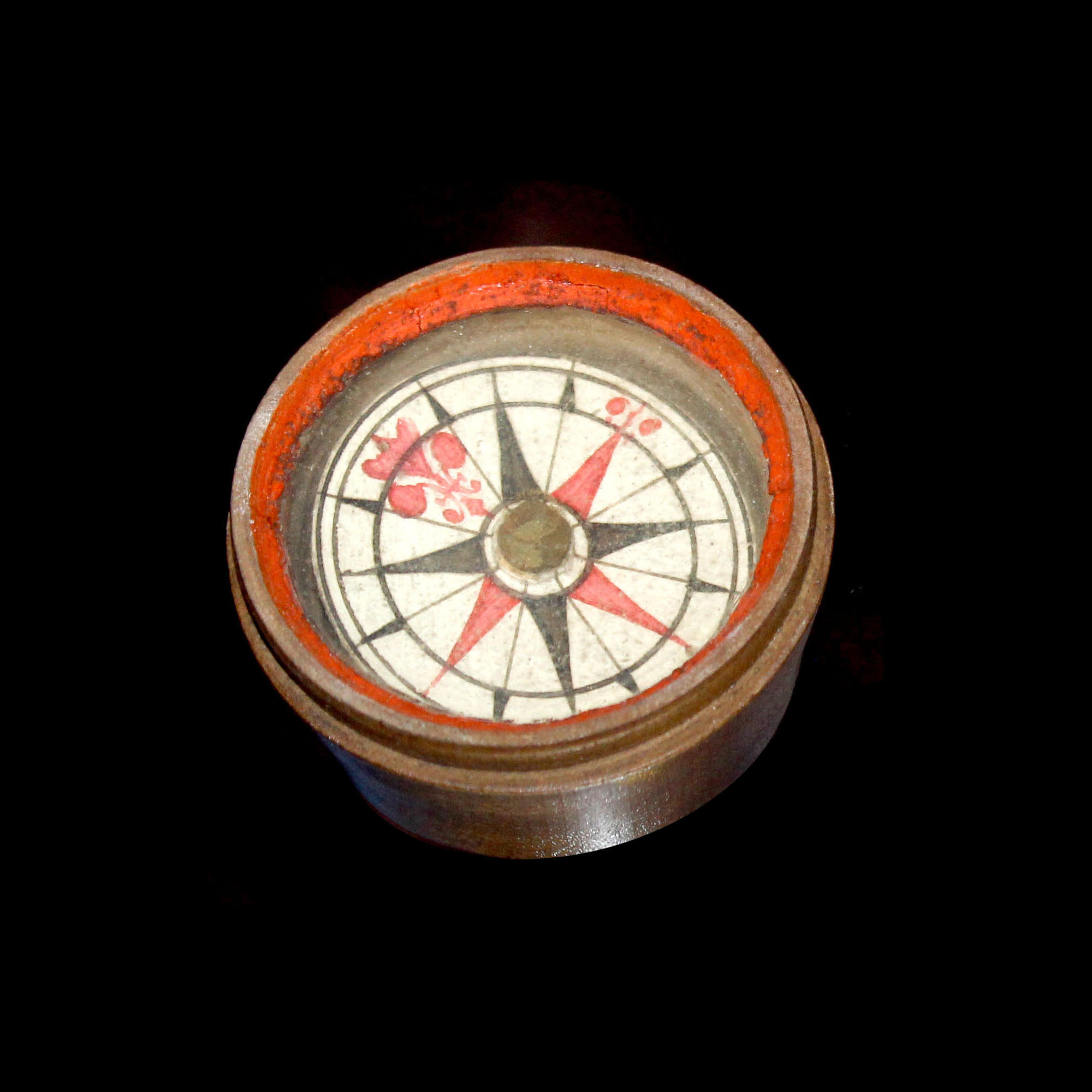


Compass of Pomors — Matochka
Creation period
end of the 19th century
Dimensions
3.9х4.9х4.9 cm
Technique
lath work, assembly work
Collection
Exhibition
2
Open in app#1

Unknown Author
Compass of Pomors — Matochka
#3
#11
Vetromet of Pomors
#12
Boat helmsmen, called ‘kormshchiks’, used to know the sea better than other seafarers. They took a note of conspicuous points ashore and told other people about them. Complex network of sea routs was recorded in hand-written pilot books which were passed on from generation to generation. The books contained detailed information on useful landmarks and ship directions.
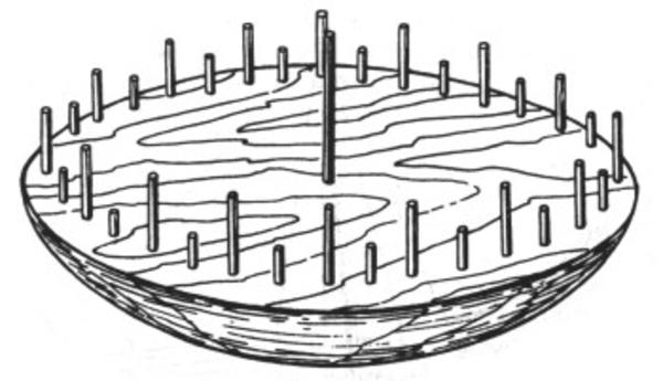
But nevertheless, it was impossible to navigate without nautical instruments in total darkness, fog or on high seas. Pomors themselves invented a device, rather simple from the modern viewpoint and called ‘vetromet’, that was both a solar clock and a compass all in one.
But nevertheless, it was impossible to navigate without nautical instruments in total darkness, fog or on high seas. Pomors themselves invented a device, rather simple from the modern viewpoint and called ‘vetromet’, that was both a solar clock and a compass all in one.
#7
Compass of Pomors — Matochka
This primitive instrument was made of wood and had no magnetized needle. Then, how could seafarers precisely find needed directions by dint of vetromet?
The base of vetromet was made in the form of spherical segment about the size of big wash basin (approximately 0.6-0.7 m in diameter). Thanks to the rounded bottom, it could be kept in horizontal plane even when the boat listed.
Holes were made on the upper flat surface divided into 32 graduated sections. Pencil-thick wooden sticks showing rhumbs were inserted in the holes. A long pin was positioned at the centre of the circle intended for finding north line by noon shadow.
In the places easy-to-see from the sea side, crosses were installed featuring cross-bars aligned with the north-south direction. To know the course within the accuracy of a rhumb, it was necessary to bring the central pin of vetromet into coincidence with the cross directly side-facing the observer.
In the open sea, cardinal directions were found by sun, and in the night time a bearing of Polar star was taken. In dull weather, they went by wind but to do that one should have sufficient experience and know the prevailing winds at the given moment.
On August 12, 1597 first documented information appeared stating that the northerners had magnetic compass and could use it properly. In fact, there is no doubt that local seafarers became familiar with the compass much earlier but still continued to use vetromets, for coastal navigation in particular.
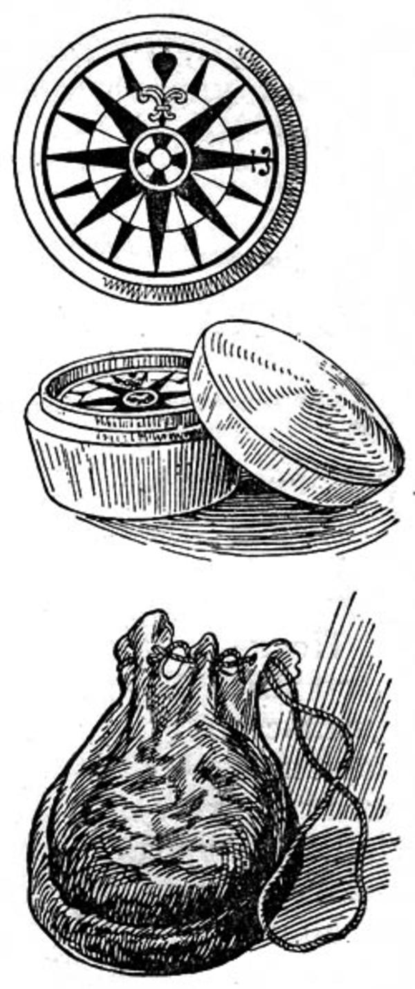
A nautical instrument called ‘matochka’ or ‘matka’, looked like a small bone or wooden box. Given the fact that in making these boxes the bones of mammoths were used common for the north of Russia but unknown in the West until the 17th century, it could be legitimately assumed that the bone types of compass were made by Pomors themselves.
It is interesting that Novaya Zemlya was also called ‘Matochka’ in old days; probably the compass of Pomors and the archipelago are somehow linked.
These instruments were passed over by right of succession; they were treated as valuable family relics. Matka was worn at the waist in a special leather bag.
The base of vetromet was made in the form of spherical segment about the size of big wash basin (approximately 0.6-0.7 m in diameter). Thanks to the rounded bottom, it could be kept in horizontal plane even when the boat listed.
Holes were made on the upper flat surface divided into 32 graduated sections. Pencil-thick wooden sticks showing rhumbs were inserted in the holes. A long pin was positioned at the centre of the circle intended for finding north line by noon shadow.
In the places easy-to-see from the sea side, crosses were installed featuring cross-bars aligned with the north-south direction. To know the course within the accuracy of a rhumb, it was necessary to bring the central pin of vetromet into coincidence with the cross directly side-facing the observer.
In the open sea, cardinal directions were found by sun, and in the night time a bearing of Polar star was taken. In dull weather, they went by wind but to do that one should have sufficient experience and know the prevailing winds at the given moment.
On August 12, 1597 first documented information appeared stating that the northerners had magnetic compass and could use it properly. In fact, there is no doubt that local seafarers became familiar with the compass much earlier but still continued to use vetromets, for coastal navigation in particular.
A nautical instrument called ‘matochka’ or ‘matka’, looked like a small bone or wooden box. Given the fact that in making these boxes the bones of mammoths were used common for the north of Russia but unknown in the West until the 17th century, it could be legitimately assumed that the bone types of compass were made by Pomors themselves.
It is interesting that Novaya Zemlya was also called ‘Matochka’ in old days; probably the compass of Pomors and the archipelago are somehow linked.
These instruments were passed over by right of succession; they were treated as valuable family relics. Matka was worn at the waist in a special leather bag.
#13
State Northern Maritime Museum
read morehide
00:00
00:00
1x
Compass of Pomors — Matochka
Creation period
end of the 19th century
Dimensions
3.9х4.9х4.9 cm
Technique
lath work, assembly work
Collection
Exhibition
2
 Point your smartphone camera to open in the app
Open in app
Share