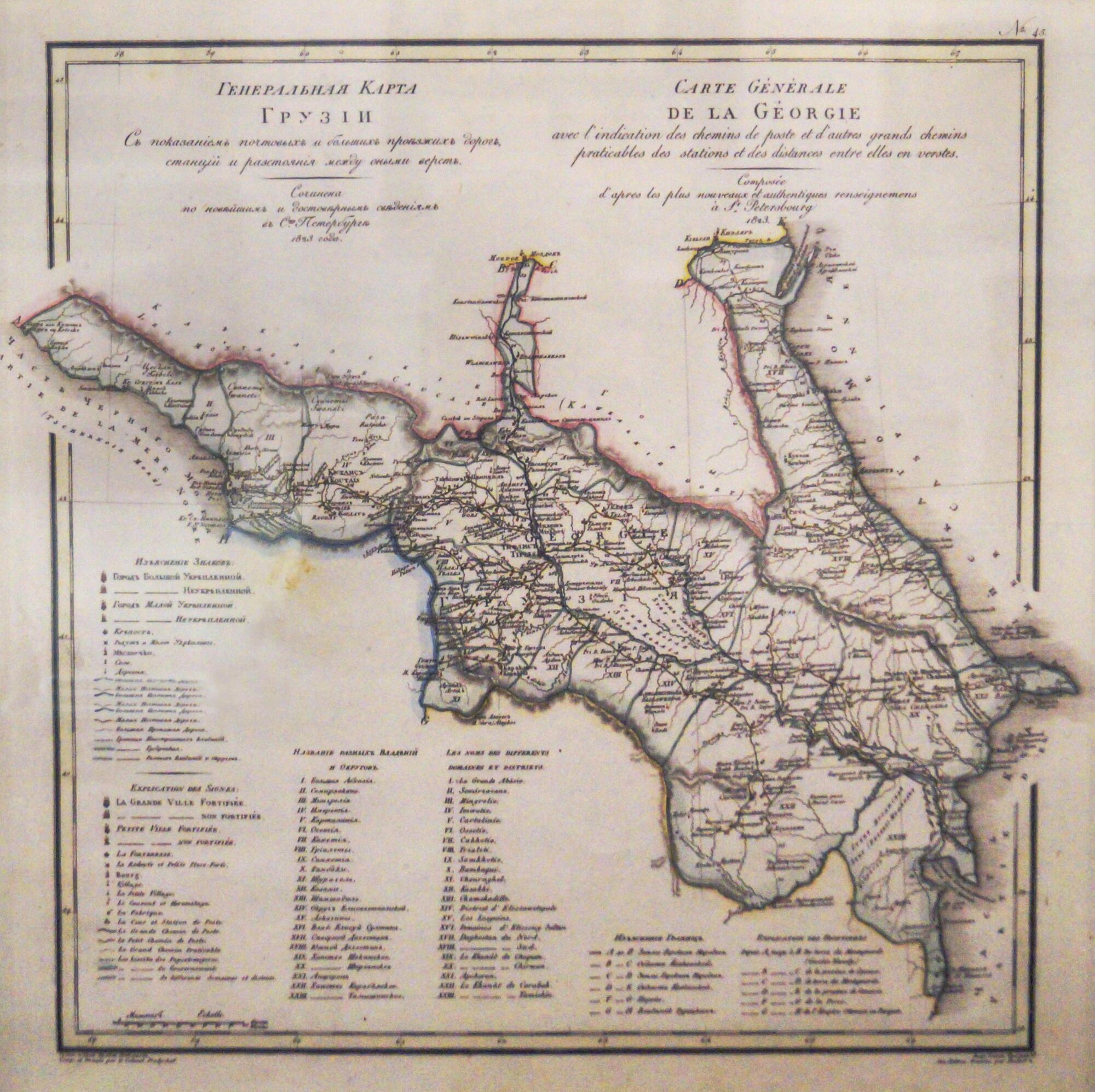
The map of Georgia created in 1823 is included in the Geographical Atlas of the Russian Empire, the Kingdom of Poland and the Grand Duchy of Finland, which includes 60 maps of the Russian Empire. The atlas was compiled and engraved by the military cartographer, Colonel Vasily Pyadyshev. On the map of Georgia, he indicated settlements (seven types depending on size), fortresses, redoubts and fortifications, monasteries and deserts, factories and plants, postal yards and stations, roads (three types), as well as state borders, borders of provinces, estates and districts. The cartographer indicated all distances in versts - a traditional Russian unit of measurement equal to 1.07 kilometers. Symbols, an index with the names of regional units, as well as geographical names are given in Russian and French.
The territory depicted on the map corresponds in general terms to modern Georgia. Previously, that country was called the Kartli-Kakhetian kingdom and united numerous independent kingdoms that arose during the period from the late Ancient world to the Middle Ages. At the end of the 18th century, Georgia asked the Russian monarch for protection from constant pressure from the Persian and Ottoman empires, and in 1801 year became part of the Russian Empire.
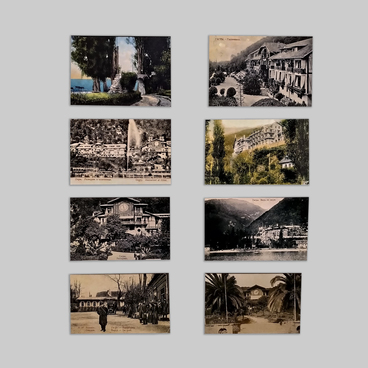
The map shows the town of Gagra, which Prince Alexander of Oldenburg wanted to turn into a full-scale resort, the ‘Russian Monte Carlo.’ In a short time, a telegraph office, a subtropical technical school, electric lighting, and water supply appeared in Gagra. And on January 9, 1903, a climate station was opened in Gagra. That date is deemed as the date of the foundation of the resort now. A park was laid out on the seashore, where agaves, palms, lemon and orange trees, and cypresses grew.
In 1904, the Gagrinsky volost (region) joined the Black Sea province and was part of it until June 1920 until it became part of Abkhazia. In 1911, the first tourists from Germany arrived in Gagra. On May 17, 1912, the resort was visited by Emperor Nicholas II.
In the modern city of Gagra, the famous park, the restaurant ‘Gagripsh’, where the opening of the climate station was celebrated, the castle of the Prince of Oldenburg and the colonnade near the Winter Theater have been preserved.