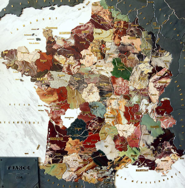
The first stone mosaic map in the world was made by masters of the Yekaterinburg Imperial Lapidary Factory. The work took two years — from 1898 to 1890. The map depicted France with all its regions, major cities, and main rivers. It was made up of individual pieces of processed colored stones — precious and ornamental.
The map of France was presented in Paris at the 10th World Art and Industrial Exhibition, where it received the highest award. The mosaic did not return to Russia: on behalf of Emperor Nicholas II, it was presented to the President of the French Republic, Émile Loubet. The map was displayed in the Louvre, in the Louis XIII Hall (Hall of Mirrors), as an example of jewelry art. Later it was transferred to the Museum of the Second Empire in the city of Compiegne, where it is still kept.
Since the Museum of Stone-Cutting and Jewelry Art History opened in Yekaterinburg, its employees wanted to organize an exhibition dedicated to one artifact — the map of 1900 France. However, for various reasons, it was not possible to arrange it. Then the director of the museum asked French delegation members that came to the Urals to send a color photocopy of the map. Her request was fulfilled in 1995. Using this photocopy, stonecutter craftsman Anatoly Zhukov created a reconstruction of the original map. To reconstruct its details as accurately as possible, the master even visited the French museum where it is stored.