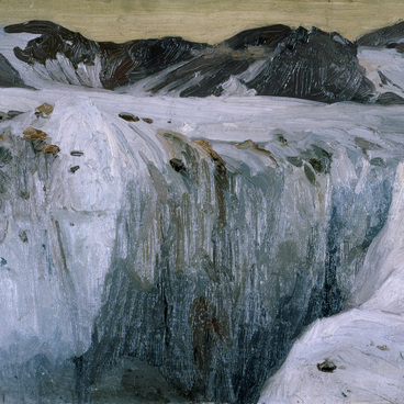
The single map sheet can hold the whole world, with all its oceans, continents, plains and mountains, countries, cities, minerals and animals. Geographic maps are models of certain areas of the Earth’s surface. The map is a guide of Earth, a signpost, or a “second language of the geography”, as it is often referred to.
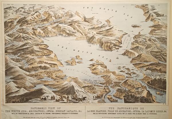
The chromolithography Panoramic view of the White Sea, Arkhangelsk, the Onega River, Russian Lapland with Military Fortifications Built by Russians according to the Drawing Published in Saint Petersburg shows the White Sea and the coastal areas of what now is Murmansk Oblast, Arkhangelsk Oblast, Republic of Karelia and Nenets Autonomous Okrug. The geographic names, written in English, are of high interest. There is the White Sea Throat, the Kandalaksha Gulf, the Onega Bay, the Dvina Bay. The names of the large rivers — Onega, North Dvina and Mezen — are written, along with the eponymous cities situated in the orifices of those rivers. Along the coast, there are names of relatively small settlements: Sosnovka, Chapoma, Chavanga, Kuzomen, Olenitsa, Chernaya, Keret, Gridino, Kem, Sumsky Posad, Vorzogory, Kyanda, Una, Letnyaya Zolotitsa, Solza, Kozly, Koida, Nes.
There are some errors and inaccuracies on the map. For example, there is a bridge not far from the Onega city, but it has never actually existed. The Onega peninsula is shown as an island. The Kanin Peninsula is shown the same way. There are many hills, and in the lower left corner, there is a mountainous area, which certainly doesn’t correspond to the flat terrain of the Russian North.
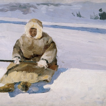
Along the bottom edge of the map, there are people performing different activities. To the left, someone is driving a reindeer sled; among the mountains, there is a military unit marching away from a group of traditionally-clad people sitting by the fire; to the right of them, there are bullock carts; in the rivers, people on float boats.
Under the map, there is an inscription: London: Published, August 29th 1855, by Read & Cº, 10, Johnson’s Ct., Fleet St.; H. Mandeville, 16, Rue Dauphine, Paris.
The chromolithography Panoramic view of the White Sea, Arkhangelsk, the Onega River, Russian Lapland with Military Fortifications Built by Russians according to the Drawing Published in Saint Petersburg shows the White Sea and the coastal areas of what now is Murmansk Oblast, Arkhangelsk Oblast, Republic of Karelia and Nenets Autonomous Okrug. The geographic names, written in English, are of high interest. There is the White Sea Throat, the Kandalaksha Gulf, the Onega Bay, the Dvina Bay. The names of the large rivers — Onega, North Dvina and Mezen — are written, along with the eponymous cities situated in the orifices of those rivers. Along the coast, there are names of relatively small settlements: Sosnovka, Chapoma, Chavanga, Kuzomen, Olenitsa, Chernaya, Keret, Gridino, Kem, Sumsky Posad, Vorzogory, Kyanda, Una, Letnyaya Zolotitsa, Solza, Kozly, Koida, Nes.
There are some errors and inaccuracies on the map. For example, there is a bridge not far from the Onega city, but it has never actually existed. The Onega peninsula is shown as an island. The Kanin Peninsula is shown the same way. There are many hills, and in the lower left corner, there is a mountainous area, which certainly doesn’t correspond to the flat terrain of the Russian North.
Along the bottom edge of the map, there are people performing different activities. To the left, someone is driving a reindeer sled; among the mountains, there is a military unit marching away from a group of traditionally-clad people sitting by the fire; to the right of them, there are bullock carts; in the rivers, people on float boats.
Under the map, there is an inscription: London: Published, August 29th 1855, by Read & Cº, 10, Johnson’s Ct., Fleet St.; H. Mandeville, 16, Rue Dauphine, Paris.