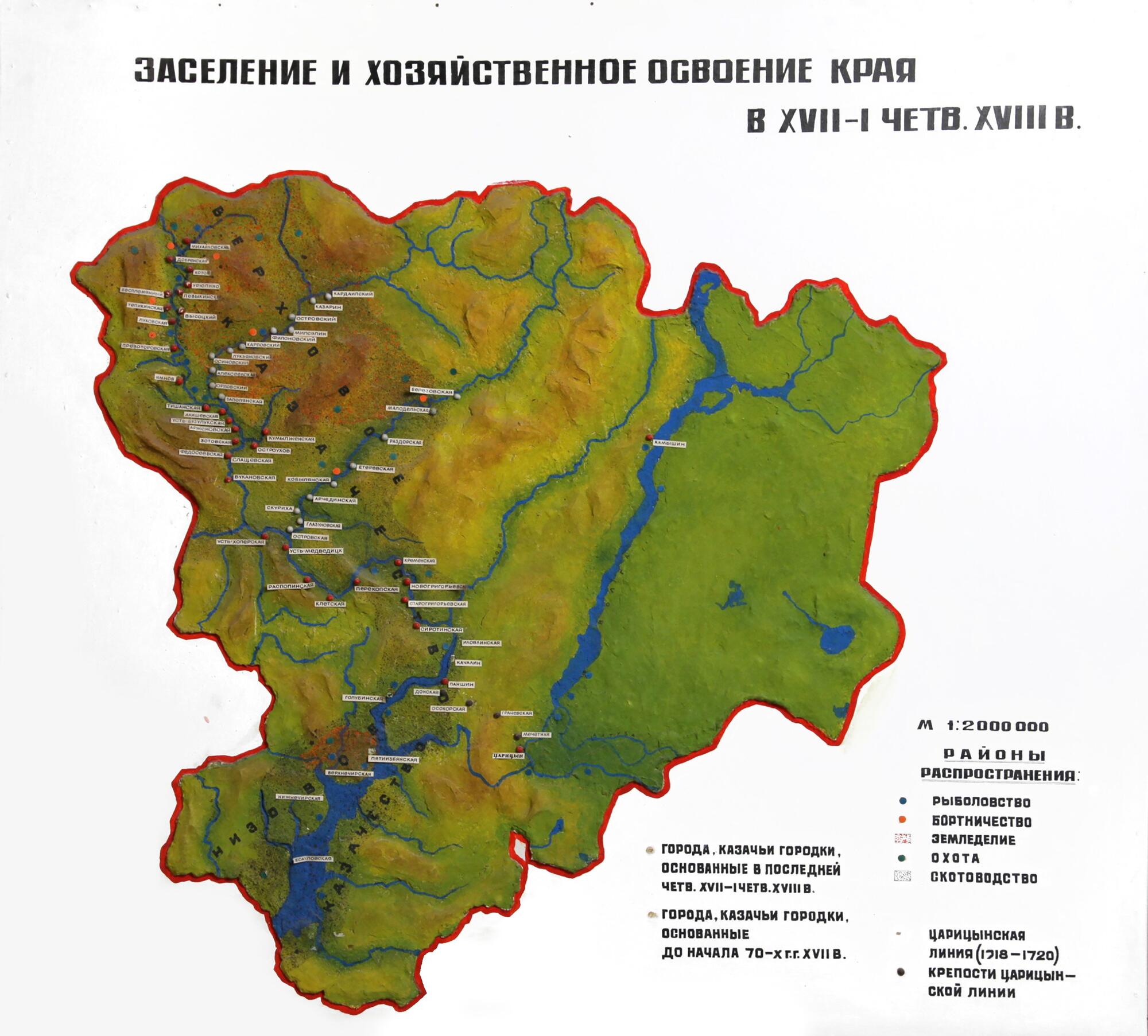
In the late 15th — early 16th centuries, Cossacks appeared along the Volga river. Some of them received payment and rations from the government and guarded the area, while others, who were free, attacked merchant caravans and diplomatic missions.
As a result, in accordance with the tsar’s decree of 1556 a military guard was established at Perevoloka, where serving Cossacks, alongside Streltsy, were on watch duty. Perevoloka was located between the Volga and the Don rivers and was a common place for nomads to cross the Volga.
It was decided to build a fort on Tsaritsyn Island. During summer seasons a small detachment of military men led by the Cossack ataman Lyapun Filimonov was stationed there. His duties included guarding the Volga trade route, cracking down on the “robbery” committed by free Cossacks, fighting against the Crimeans, and ensuring the safe passage of diplomatic embassies.
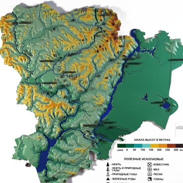
Other fortified strongholds soon appeared along the Volga. An Englishman, Christopher Burrough, who traveled along the Volga in 1579, counted six such “towns” in the Perevoloka-Astrakhan area. Ivan the Terrible’s government was engaged in a long Livonian war and could not do more in this region. Only in the early 1580s a real opportunity to build fortress-cities along the Volga emerged and as a result a powerful outpost line was set up. Samara was the first to be built in 1586 followed by Tsaritsyn, which became an important strategic fortress by the mid-17th century.
In 1720, the construction of the Tsaritsyn guard line, some 60 versts long and up to 10 meters high, was completed. It was one of the largest fortification structures in Europe. The defense line of the Russian Empire bridged the isthmus between the Don and Volga Rivers. It was in service from 1720 to 1776.
The emergence of this fortification line had an impact on the social, economic and political development of the region. The number of peasants moving from central provinces of the country to the Volga region increased sharply; farming, melon and vegetable growing developed, and silkworm breeding started to take off.
As a result, in accordance with the tsar’s decree of 1556 a military guard was established at Perevoloka, where serving Cossacks, alongside Streltsy, were on watch duty. Perevoloka was located between the Volga and the Don rivers and was a common place for nomads to cross the Volga.
It was decided to build a fort on Tsaritsyn Island. During summer seasons a small detachment of military men led by the Cossack ataman Lyapun Filimonov was stationed there. His duties included guarding the Volga trade route, cracking down on the “robbery” committed by free Cossacks, fighting against the Crimeans, and ensuring the safe passage of diplomatic embassies.
Other fortified strongholds soon appeared along the Volga. An Englishman, Christopher Burrough, who traveled along the Volga in 1579, counted six such “towns” in the Perevoloka-Astrakhan area. Ivan the Terrible’s government was engaged in a long Livonian war and could not do more in this region. Only in the early 1580s a real opportunity to build fortress-cities along the Volga emerged and as a result a powerful outpost line was set up. Samara was the first to be built in 1586 followed by Tsaritsyn, which became an important strategic fortress by the mid-17th century.
In 1720, the construction of the Tsaritsyn guard line, some 60 versts long and up to 10 meters high, was completed. It was one of the largest fortification structures in Europe. The defense line of the Russian Empire bridged the isthmus between the Don and Volga Rivers. It was in service from 1720 to 1776.
The emergence of this fortification line had an impact on the social, economic and political development of the region. The number of peasants moving from central provinces of the country to the Volga region increased sharply; farming, melon and vegetable growing developed, and silkworm breeding started to take off.