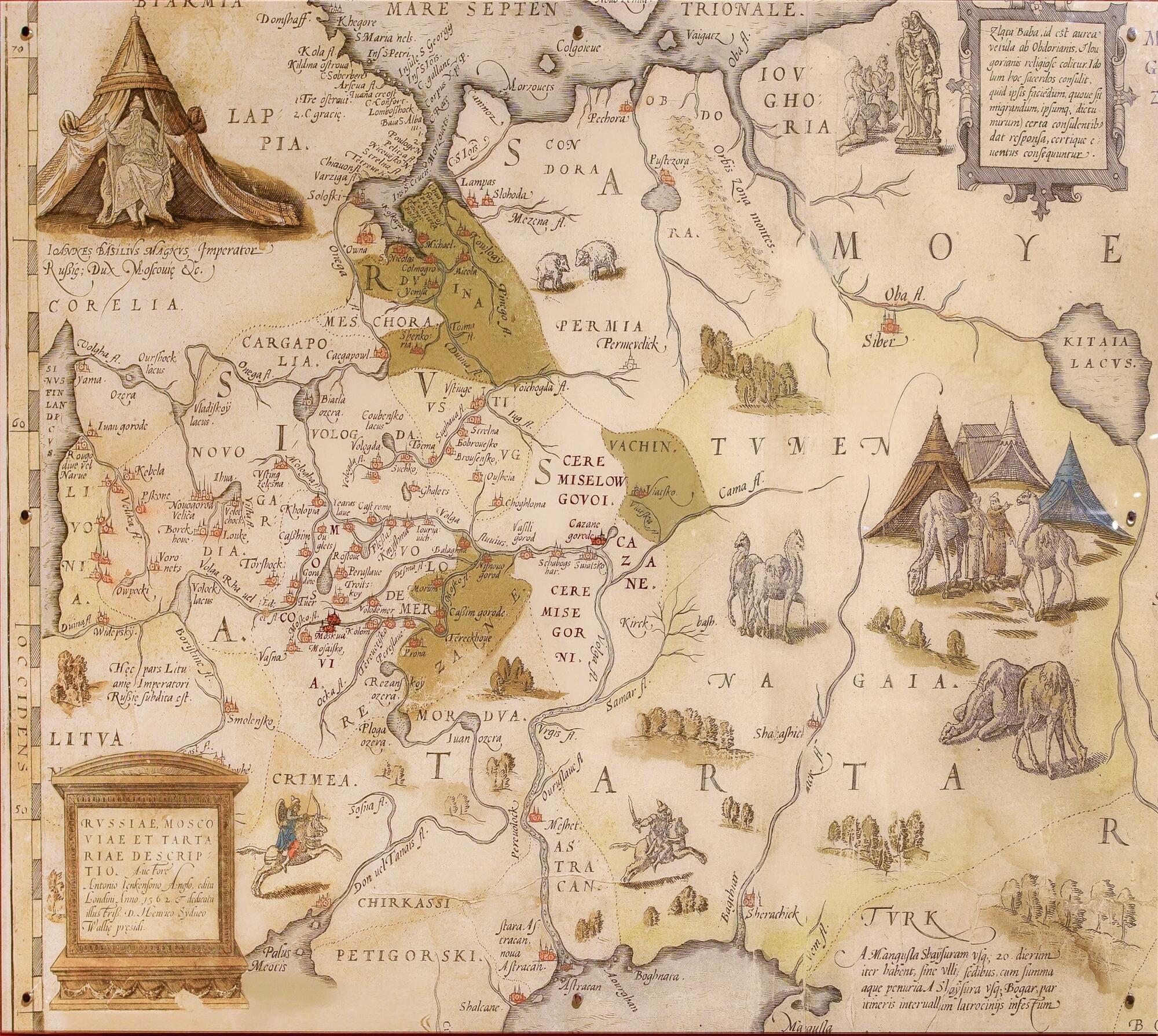
The National Museum of the Republic of Mari El houses a copy of the fragment of the ancient map “Description of Russia, Muscovy and Tartary”. The original was made by Anthony Jenkinson, an English explorer, merchant, and diplomat, who negotiated with Ivan the Terrible on behalf of the English queens — Mary I and Elizabeth I. Moreover, Jenkinson represented the Muscovy Company, an English trading company. In 1558, Ivan the Terrible issued a document protecting Jenkinson’s life and property, and Jenkinson went on a two-year trip to Central Asia.
As a result, Anthony Jenkinson made many reports and travel notes as well as the most detailed map of Russia, the Caspian Sea, and Central Asia at that time. The map called “Description of Russia, Muscovy, and Tartary” was published in London in 1562.
The left corner of the map features a portrait of Tsar Ivan the Terrible with a Latin inscription Ioannes Basilius Magnus Imperator Russian; Dux Moscoviae, which means: “John Basilius (most likely, Vasilyevich), the Great Emperor of Russia, Duke of Muscovy.” The map also has degrees of latitude and graduated scales of the Russian, English, and Spanish measures.
There were quite a lot of mistakes in Anthony Jenkinson’s documents. Historians explained this by the fact that the explorer used drawings and maps that had been published earlier and were not always accurate. For instance, the border of Muscovy in Jenkinson’s map differed from the real one of the 1550s — 1560s, and Astrakhan was marked as a separate state.
A Soviet scientist Boris Rybakov analyzed the “Description of Russia, Muscovy, and Tartary” in his book “Russian maps of Muscovy of the 15th — early 16th centuries”. He wrote,
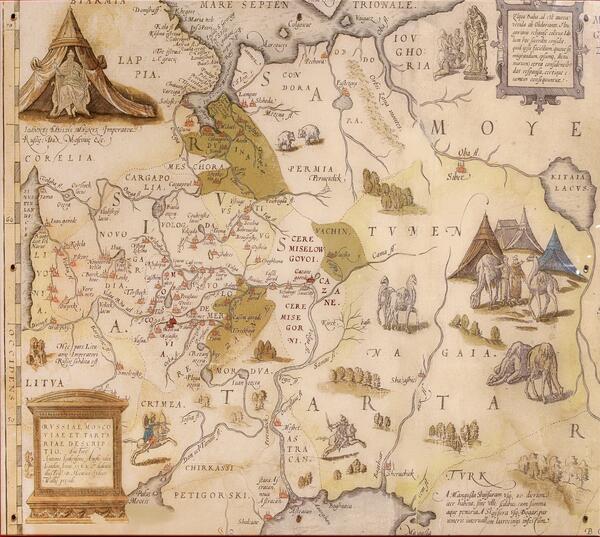