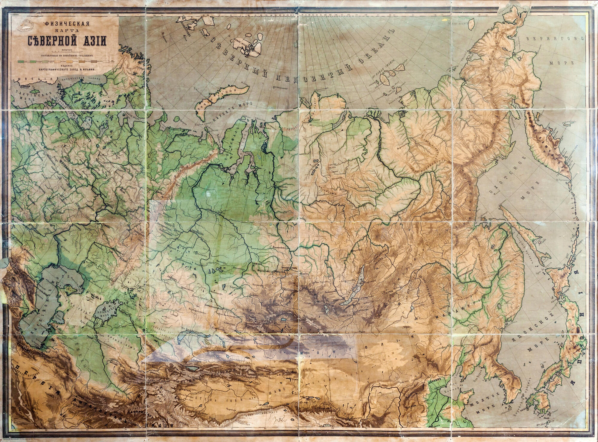

A physical map of North Asia, ‘compiled according to the latest information, ” is hung in the dining room of the Ulyanovs’ house next to the map of Europe. They were both compiled and printed by the St. Petersburg Cartographic Establishment of Alexey Afinogenovich Ilyin in the second half of the 19th century.
Anna Ulyanova-Elizarova recalled that the furnishings in the house were always very simple, even puritanical, and new things were hardly ever bought. Portraits and paintings did not hang on the walls, but the rooms were decorated with geographical maps, which were purchased for the children by Ilya Ulyanov.
The small-scale map in the exhibition covers the entire territory of North Asia. The map is physical in content — the relief of the land surface and hydrographic objects can be clearly seen. General geographic information is also shown, but only the most basic: the borders of states depicted by dashed lines, major cities, and major trade roads, or highroads (known as tracts). States, colonies, and disputed territories are shown within the borders of the second half of the 19th century.
The Russian part of North Asia occupies a large part of the map. It is shown in detail with all the physiographic features known at the time: river systems, lakes, swamps, seas, oceans, bays, and straits. The coastlines are marked in bold blue lines.
Elements of relief — mountains, plains, lowlands — were painted using the hypsometric method. The essence of this method was that the relief was painted in layers according to height steps. The higher above the sea level the object was located, the more layers of color was painted on the object.
Alexey Ilyin Establishment developed its scale of heights. The number of steps depended on the scale of the map, but usually, there were no more than 10-16; otherwise, it became difficult to distinguish the boundaries. The scale for the land was printed in colors ranging from dark green, which corresponded to the depths below the sea level, to dark brown, which marked the highest peaks. The topography of the seabed was colored in blue in the same way — the deeper, the darker.
The map displayed at the exhibition is not authentic — it did not belong to the Ulyanovs. It was sent to the House-Museum by the geographical division of the Leningrad Establishment of Scientific Pedagogy in 1929 at the request of the restoration commission.