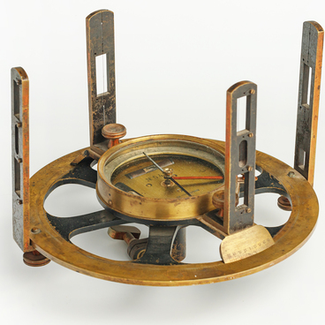
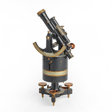
The surveyor’s compass, or bussola, is an obsolete geodetic instrument resembling a compass — but it is far more than a simple directional tool. It is a highly accurate measuring device specifically designed to determine the magnetic azimuths of directions on the ground. Unlike a standard compass, the surveyor’s compass features a more sophisticated design that significantly enhances measurement precision. Its construction accounts for factors such as magnetic declination and interference from external magnetic fields that made it an indispensable instrument in professional geodesy.
The history of the surveyor’s compass stretches back several centuries. Early prototypes that used the Earth’s magnetic field for orientation first appeared in ancient China, where they were used for navigation and geomantic practices. However, the bussola evolved into a specialized geodetic instrument much later — during the Age of Exploration, when the demand for precise measurements became critical for mapping newly discovered territories and improving navigational accuracy.
The surveyor’s compass played a pivotal role in multiple fields. Thanks to this instrument, cartographers were able to produce detailed and reliable maps, greatly facilitating navigation and the exploration of unknown lands. It was also widely used in topographic surveys, boundary demarcation, and the determination of ground point coordinates. Geologists used the surveyor’s compass to study rock formations, measure the strike and dip of strata, and analyze the structure of the Earth’s crust.
Today, the surveyor’s compass has been superseded by modern electronic instruments and is now primarily regarded as a historical artifact. Nevertheless, studying its design and operating principles offers valuable insight into the evolution of geodetic technology and highlights how simple yet effective tools enabled humanity to chart and understand the world.
Nikolai Ivanovich Kuznetsov — the future legendary Soviet intelligence officer and Hero of the Soviet Union — acquired geodetic skills during his studies at the Talitsa Forestry College, where he learned to use instruments such as the surveyor’s compass. He likely used it during field exercises in terrain orientation, angle measurement, and map sketching. These competencies proved invaluable in his later clandestine operations during the Great Patriotic War, where the ability to accurately determine direction and distance could mean the difference between life and death.