World War I was the first global military conflict, in which 38 out of 59 independent countries that existed in the first half of the 20th century were involved. More than 70 million people were mobilized around the world. In the confrontation between two coalitions — the Triple Entente (Russia, France, Great Britain) and the Triple Alliance (Germany, Austria-Hungary, Italy) — the losses of the parties amounted to almost 10 million killed and over 19 million wounded.
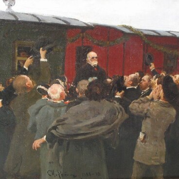
In the summer of 1914, at the beginning of the war, peacetime military medical institutions operated in the capital of the Russian Empire, Petrograd (St. Petersburg). These were mainly the hospitals of the Imperial Military Medical Academy, concentrated on the Vyborg side: the Clinical Military Hospital on Pirogovskaya Embankment, Mikhailovskaya Clinical Hospital of Baronet Willie on Bolshoy Sampsonievsky Avenue, Nikolaevsky Military Hospital on Suvorovsky Avenue and Semyonovsky-Alexandrovsky Military Hospital on Lazaretny Lane which would later house the Military Medical Museum. There were also military infirmaries ‘for the sick and wounded military ranks, and partly for the workers of military-technical workshops and factories.’ In August 1914, almost all employees of the listed institutions went to the front line.
In the first weeks of the war, an additional network of infirmaries and hospitals was urgently required. The authorities modified civilian medical facilities to treat the wounded. However, the number of beds available ended rapidly: so many wounded, shell-shocked and sick soldiers arrived in Petrograd that the help of civilians was needed for their treatment.
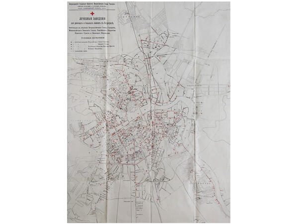
In a short time, several hundred private-funded infirmaries were established in the city. They were located on more than 250 avenues and streets. In Tsarskoe Selo, for example, there were 40 medical institutions. And almost all of them were opened and supported by private donations of the townspeople: doctors, merchants, scientists, professors and teachers, as well as by charitable associations, boards of trustees and foundations, enterprises, banks, and educational institutions. Thus, during World War I, Petrograd turned into a real hospital city. The map of these hospitals is displayed in the exhibition of the Military Medical Museum.

Map “Medical Institutions…”
Creation period
1916
Dimensions
108x71 cm
Technique
typographic printing
Collection
Exhibition
1
Open in app#4
Map ‘Medical Institutions…’
#2
#3
Ministry of Culture of the Russian Federation
read morehide
00:00
00:00
1x
Map “Medical Institutions…”
Creation period
1916
Dimensions
108x71 cm
Technique
typographic printing
Collection
Exhibition
1
Open in app
Share